Trail Walking Comuna 13 - San Javier - medellin - Photo
© OpenStreetMap contributors
Length
Length
43 km
Max alt
Max alt
2616 m
Uphill gradient
Uphill gradient
2325 m
Km-Effort
Km-Effort  
72 km
Min alt
Min alt
1463 m
Downhill gradient
Downhill gradient
1780 m
Boucle
Boucle
No
Creation date :
2023-12-13 13:55:10.365
Updated on :
2023-12-24 15:09:45.644

(0 Reviews)

Walking
Walking
5h29
Difficulty : Very easy

Scan this QR Code to open this trail in the SityTrail application

FREE GPS app for hiking

Logo SityTrail SityTrail

IGN / Geographical institutes

Download SityTrail from the App Store Download SityTrail from Google Play

Logo SityTrail SityTrail World

The world is yours!

Download SityTrail from the App Store Download SityTrail from Google Play Download SityTrail on Huawei AppGallery

About

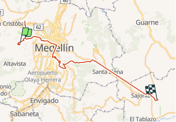
Trail Walking of 43 km to be discovered at Antioquia, Medellín, Comuna 13 - San Javier. This trail is proposed by patcaillou.

Elevation profile

Positioning

Country:
Colombia
Region :
Antioquia
Department/Province :
Medellín
Municipality :
Comuna 13 - San Javier
Location:
Unknown
Start:(UTM)
431264 ; 690907 (18N) N.

Trails nearby

Trail Walking  - Epic - Photo
Walking
fmperrin

Walking

Medium
, Antioquia, Envigado, Colombia
3.9 km | 5.9 km-effort
58min
Yes


Close
My subscriptions